Comprehensive Surveying Services Provided for Texas Public Library
Flood Study, Topographic & Tree Surveys, Boundary Surveys & Easements Client: City of Cedar Hill […]
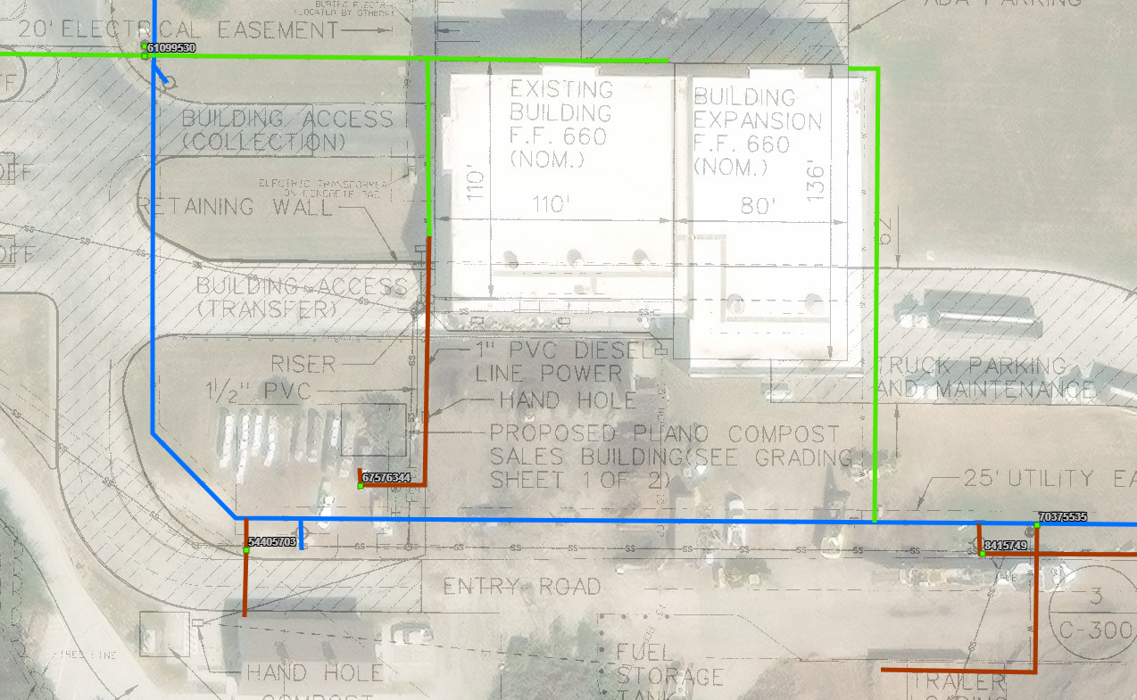
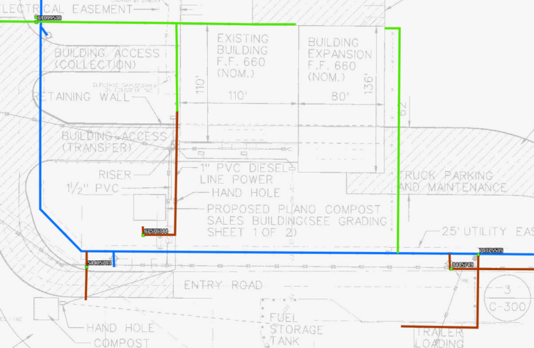
Weaver Consultants Group (WCG) performed field surveying and Geographic Information System (GIS) mapping to assist a client in Northern Texas with utility inventory and infrastructure management. Multiple entities operated on the transfer station facility, and the client was uncertain about billing and the assignment of water meters across the site.
WCG mapped the located water appurtenances in GIS to geo-reference engineering plans and as-built records to the located water meters. These services enabled the client to achieve appropriate billing separation and acquire new permits from the city for proposed developments.


Flood Study, Topographic & Tree Surveys, Boundary Surveys & Easements Client: City of Cedar Hill […]

3-Dimensional Modeling, Aerial Photography, Historical Image Overlays, and Site Land Surveying Services Client: National Solid […]